Climb Frenchman's Peak!
15th July, Esperance, Cape La Grande National Park, Australia
The Esperance region is fortunate enough to be surrounded by four beautiful National Parks. Situated 56km east of Esperance, Cape Le Grand National Park is the most accessible and the best known of the four. Arriving only yesterday and being new in town, we had yet to find out what there is to do around here. We had a head start, though, as Ian's brother, Andy (who has travelled around Aus before), had sent us a text message with the advice: 'Climb Frenchman's Peak and have a look from there'. That was our focus for today, find the peak and conquer it.
As we approached Cape Le Grand, we noticed a change in the landscape - it looked rugged, green and untouched. We could see the many vegetation-covered sand dunes and towering granite mounts on either side of the road. Every now and then as we turned a bend, we could see a glimpse of the sea glistening away in the distance.
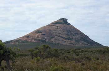
We eventually found Frenchman's Peak and then the realisation set in. So, this was the oddly-shaped peak that we could see from our campsite, 56km away.

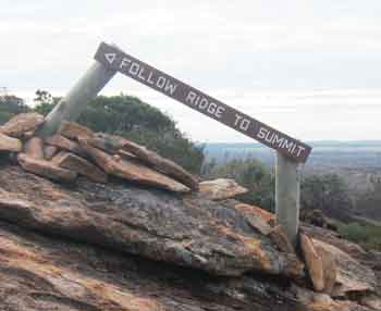
Looking up at this giant piece of granite, it suddenly dawned on us that there was no footpath, just white posts dotted around sporadically to indicate gentler inclines. The sign at the beginning of the walk confirmed it all really - this was going to be a '2 hour hard walking trail that should only be attempted by fit visitors'. They weren't wrong there. Although I would have added, 'not suited to those who suffer from vertigo' as well. Looking at the starting point all the way up to the summit, I could only imagine scaling up there with abseiling gear or some suckers attached to my hands and feet. It sure looked steep but we managed to convince ourselves it was still do-able. And so we made a start.
This was before it got steep - the easy part!
Clambering up the naturally formed, randomly spaced foot holes, I made an effort not to look down too often! It was every bit as steep as it looked. In the back of my mind I was already wondering how we were going to come back down, whether to walk backwards etc. By the time we reached the top, I must have guzzled down a gallon of water. It was worth the effort though as the views were amazing and we could see for miles in all directions. From the top, we could see the many bays, beaches, lakes, green fields, other granite mounts, sand dunes and islands (of the Archipelago of the Recherche) spreading out below us like a piece of detailed tapestry.
It's weird to be under a cave roof this high up a mound of granite.
Ian sitting at the summit, looking out towards one of the many bays in
Cape Le Grand.
On the descent, we concentrated on one slow step at a time. Believe me, this was difficult as gravity was more than willing to give a helping hand! At one point we lost the 'suggested path' route as the posts were very spaced out. That or someone had taken a post and used it as a walking stick instead! Amazingly, we managed to reach the bottom unscathed ... down an even steeper gradient than on our way up. It was definitely not the best route down and I can imagine it being extremely dangerous in wet conditions but we both placed our faith in Adidas and had somehow made it.
Once we had taken a well-earned rest, we moved on to Hellfire Bay. A couple of hippies we'd met a few days ago had mentioned that they'd seen some seals at the bay that were 'totally awesome, man'. Looking around, we could see why the seals would love this place. The rocks on the side would be a perfect haven for them. But alas, we didn't see any today. The bay looked beautiful and we found we were the only ones there. It would have looked even better if we could see it from a higher elevation. I scanned the horizon and could immediately spot several potentials. The mind was willing but the legs had the final say and we gave it a miss. We'd done enough climbing for one day!


